RIMS
Rail Inventory Management System
Created by TavlaSolutions
Utilize your data to the fullest through:
- Communication
- Access
- Analysis
Communication
RIMS lets you communicate your data easily between multiple parties:
- Within your organization
- With your collaborating organization (state or railroad)
- With the regulatory organization (FRA)
Communicating within your organization
RIMS allows you to communicate with your colleages through sharable page links and crossing linked documents and images. User rights are designed to support a hierarchical QA/QC process.
Communicating with collaborative organizations
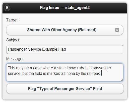
If something seems amiss in data that you are not responsible for updating, RIMS allows you to flag that field and notify the state or railroad of your concern. There are also multiple bulk data export formats for sharing data with organizations that are not using RIMS.
Communicating with the regulatory organization
Data that you have approved, and that doesn't currently exist in the FRA database (we check), is added to a queue for immediate submission to the FRA GCIS API. This process is robust and designed to handle FRA GCIS API downtime. As their electronic data submittal policies change, we will change with them, so you don't have to modify your workflow!
Access
RIMS provides access to your data wherever you are:
- In the office
- In the field
- Offline when internet access isn't available
Access in the office
As a Web application, RIMS works in any modern browser on all operating systems; Windows, Mac and Unix/Linux.
Access in the field

Online or offline
Access your data from any internet enabled device, or plan ahead for areas with no signal using our offline mode.
Analysis
RIMS provides integrated methods for analyzing your data:
- Rating models
- Geospatial analysis
- Custom cost-benefit models
Rating Models
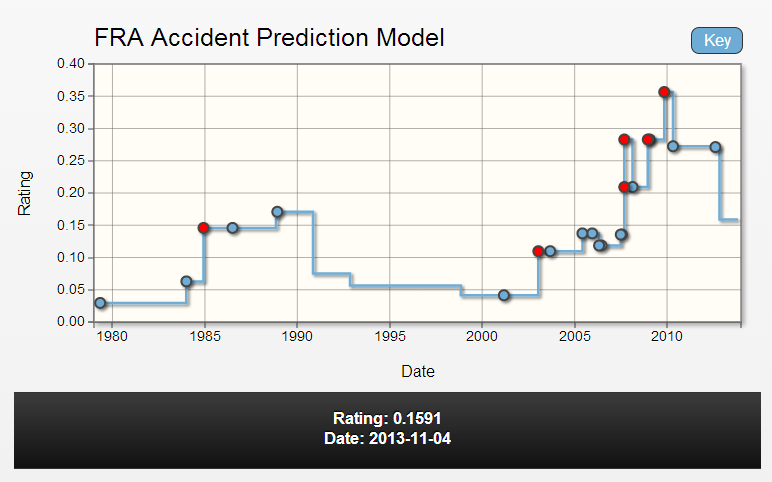
In addition to the standard FRA Accident Prediction Model, custom models can be included for your organization.
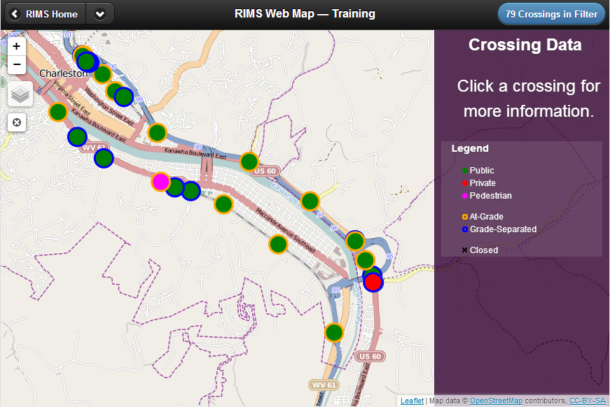
Geospatial Analysis
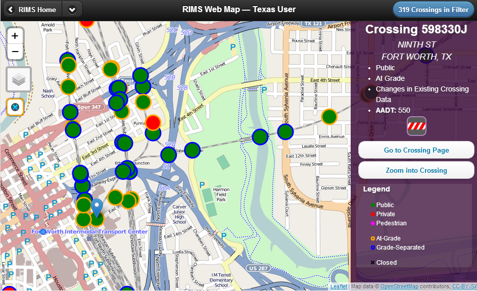
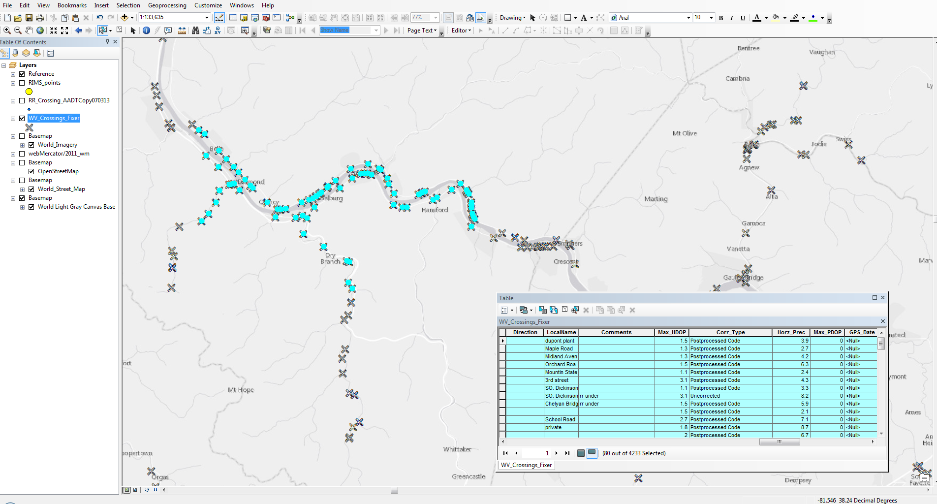
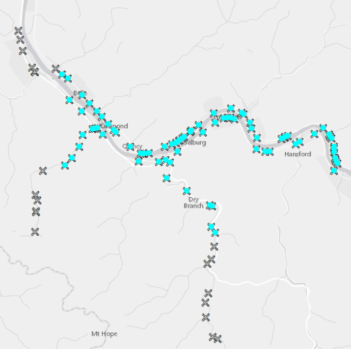
View crossings in the integrated Web map, or export data for use in third party viewers or GIS products.
TavlaSolutions
Services:
- GIS Analysis
- Project Prioritization
Services:
GIS Analysis
- Inventory Support Tool
- Overview Dashboard
- Spatial Analysis
- Network Analysis
- Georeferencing
- Web Services
Inventory Support Tool
Create your network and let the analyses begin...
Inventory Support Tool
Start by promoting inventory completeness and accuracy with a spatial view of track, crossing, and facility information.
Inventory Support Tool
Tavla can help you validate the network topology and route attribution of your transportation network.
Data Validation
Data Validation
Locate anomalies in your inventory.
Verify information with other State and Railroad sources.
Integrate with other modes of transportation.
Flag information that doesn’t meet initial standards for further review.
Overview Dashboard
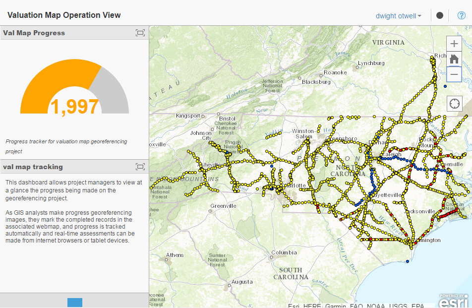
Overview Dashboard
Track your completeness to meet short-term and long-term objectives. Let Tavla Solutions help you establish your goals by choosing metrics, guiding your path and seeing the realization of goals.
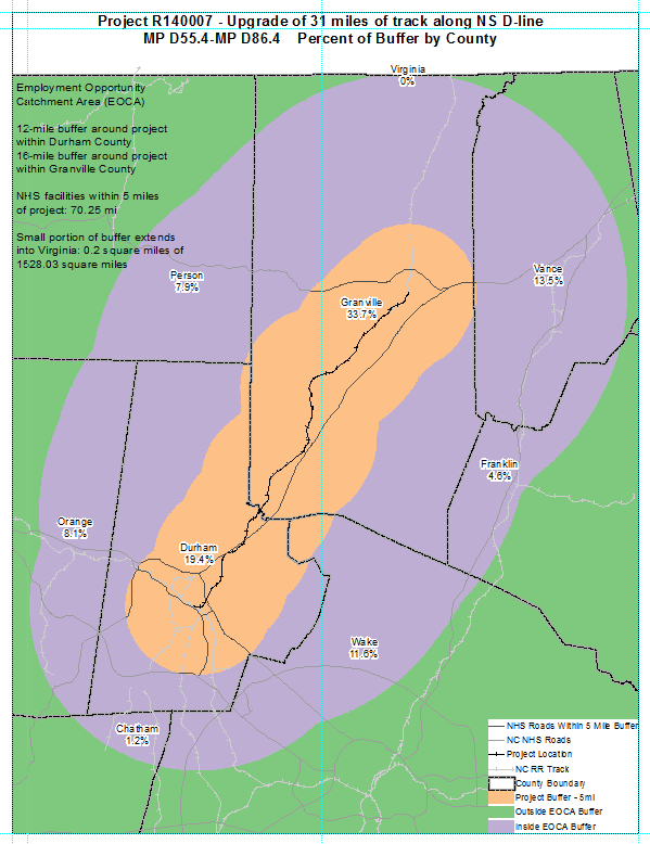
Spatial Analysis
Support goods movement and rail infrastructure initiatives by exploring the spatial relationship between your assets and other features on the ground. Analyze demographic and environmental impact, assess quiet zone impacts, and capture land use characteristics and their relationship to your facilities.
Network Analysis
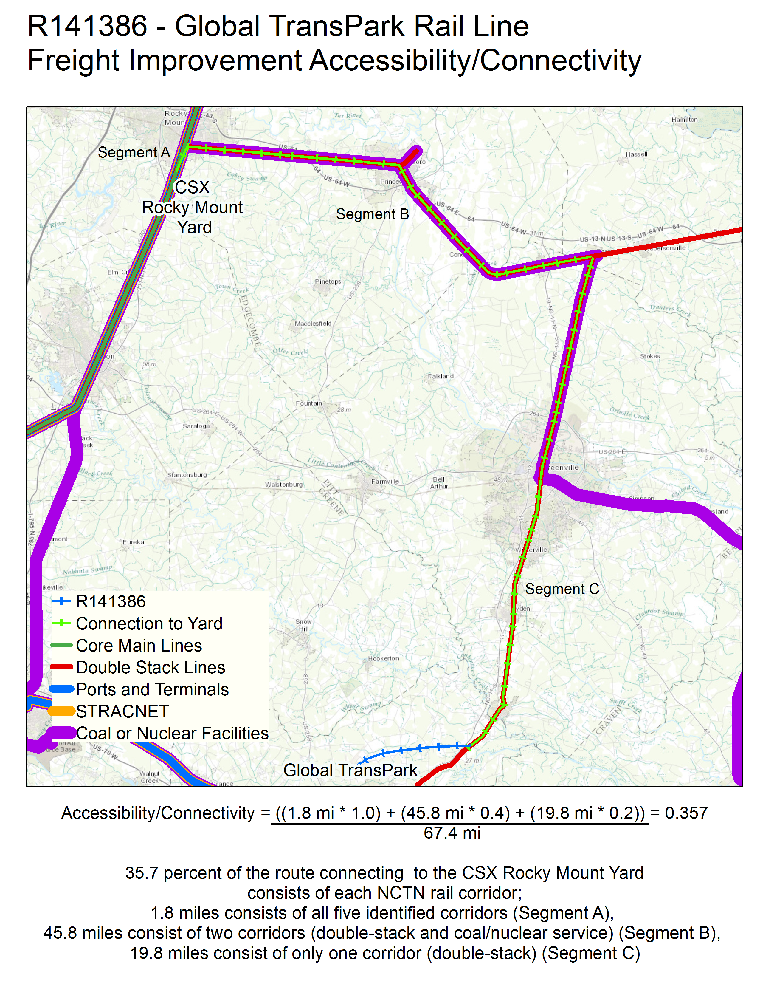
Network analysis allows our clients to predict the impact of crossing incidents, estimate the economic benefits of competing projects, asses the security of existing infrastructure, and identify the system wide impact of local and regional projects.
Georeferencing
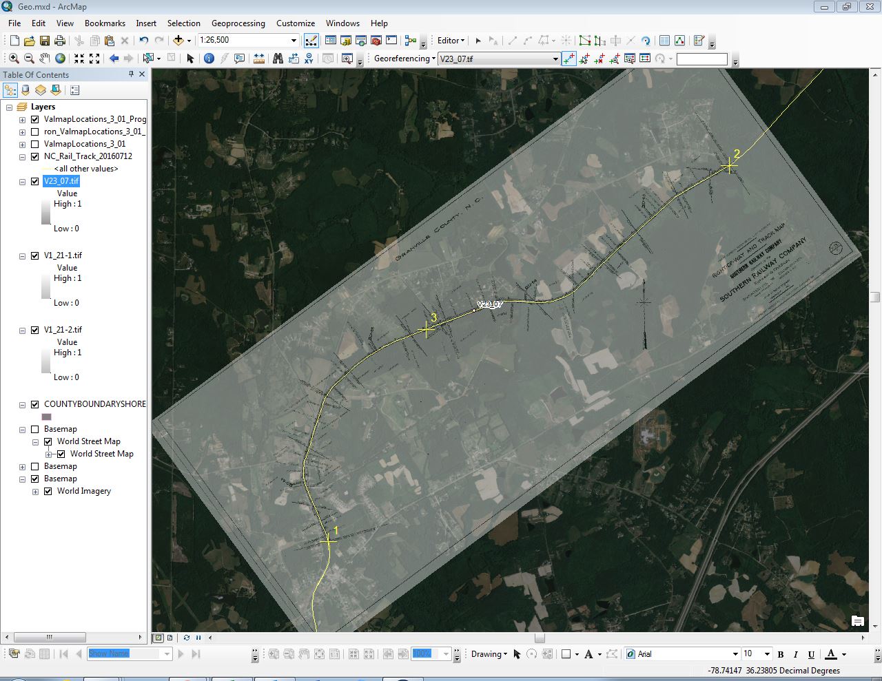
Georeferencing
Migrate legacy image datasets to a spatial environment to extract further value from existing resources. Put supporting details and historic geographic features in context to support decision making.
Web Services
Web Services
Collaborate in an online environment.
Enable multiple stakeholders to make edits, submit requests, and comment on work in progress in real time.
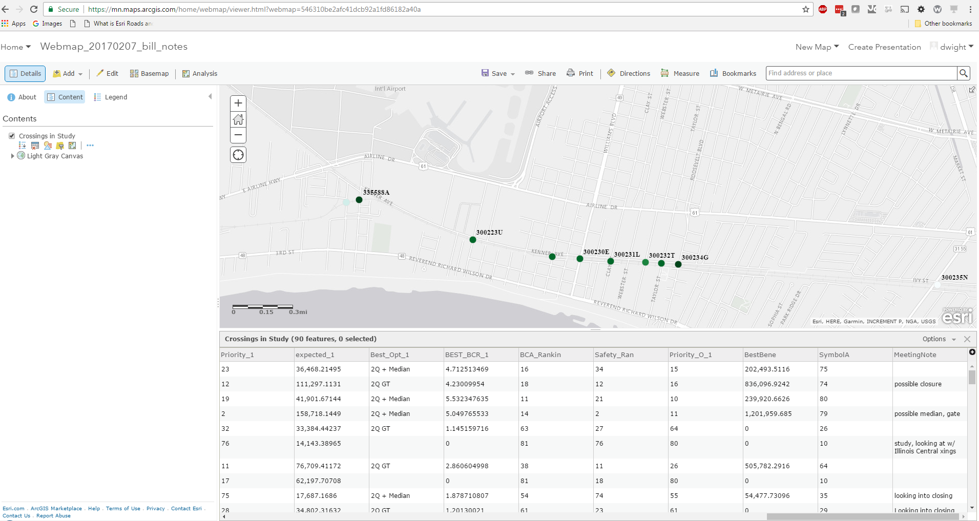
Project Prioritization
- Project Selection
- Benefit Cost
- Corridor Analysis
Project Selection
Government organizations want a transparent process that provides easy to understand project selection results.
From initial ideas and justification to ranking and selection, let Tavla Solutions streamline your selection process.
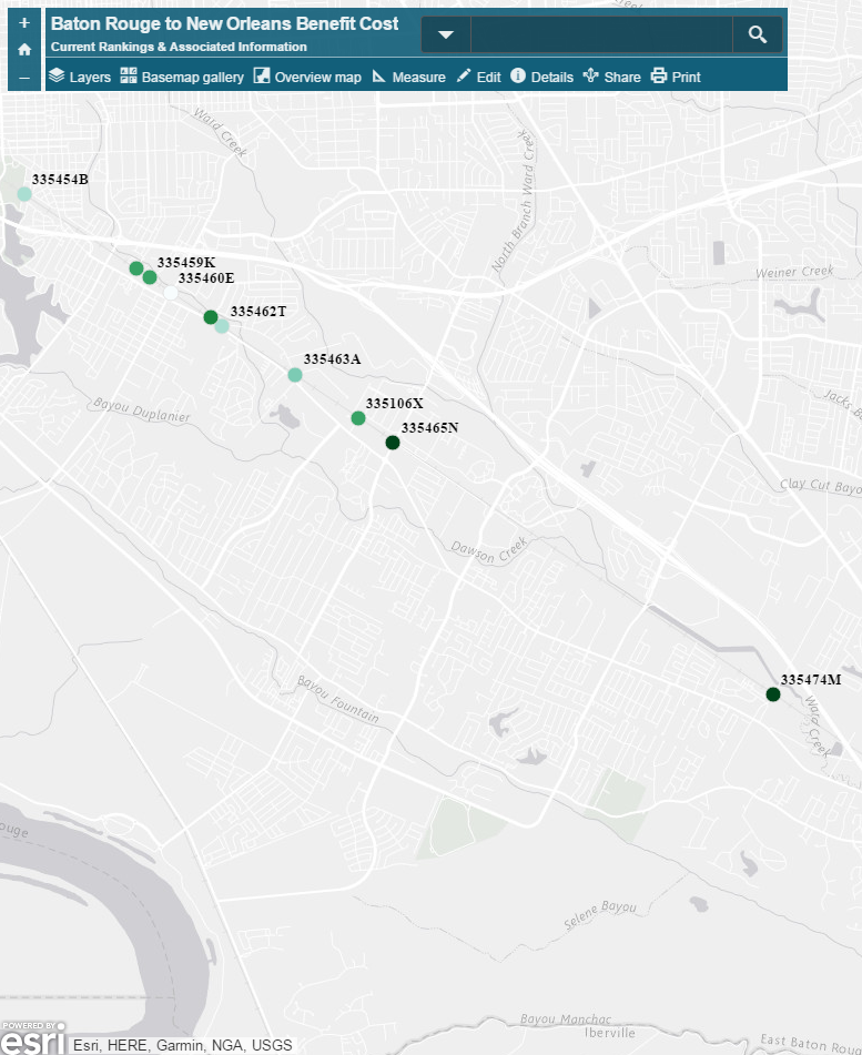
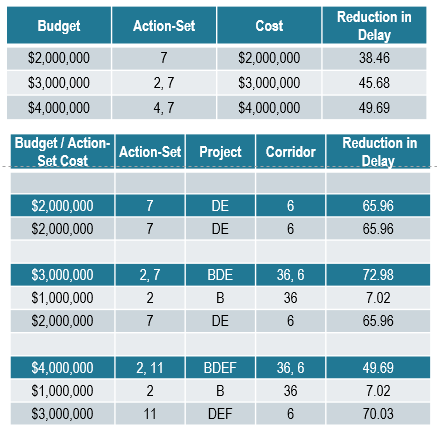
Benefit Cost
The ability to rank projects across modes can only happen when the comparison uses a common structure.
Project cost can be evaluated in ratio to public benefit to determine the Benefit Cost Ratio of the projects that should be included in funding schedules.
Benefit Cost
Let Tavla Solutions handle the calculations...
...and simplify your Benefit Cost Analysis with a complete process review.
Corridor Analysis
Program your project dollars to their fullest. Corridor Analysis can show you the best combination of projects for a safer network.